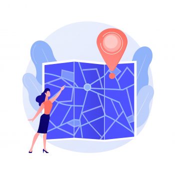
Enterprises, government agencies, and law enforcement use Cobwebs Technologies’ geospatial data and spatial analysis to get location intelligence, which is a powerful tool to understand situations or events, get insight into, e.g., where events take place and who is involved to make informed decisions. Companies use location intelligence to, e.g., pinpoint optimal locations for their brick-and-mortar stores, government agencies use it in time of, e.g., natural disasters such as wildfires, and law enforcement uses it to identify the locations of threat actors, crime syndicates, criminal acts, and mass events turning into riots. In other words, location-based data provides unique insights, reveals hidden relationships, patterns, and trends that are crucial for follow-up.
In general, harnessing geospatial data requires a geospatial intelligence platform. Collecting enormous amounts of location-based data on the surface, deep, and dark web is extremely labour-intensive. Due to limited budgets and time restraints, a user-friendly WEBINT platform is needed that scrapes from all layers of the web, analyses the collected data, and presents the actionable results in a user-friendly GUI. The cutting-edge location solution of Cobwebs Technologies automatically reveals and analyses location-based data using interactive maps. It only collects open-source data to comply with the stringent statutory rules and regulations regarding data protection. This allows analysts and investigators to efficiently generate intelligent insights from the huge amounts of hidden and complex OSINT data. Connecting open-source web data with live and real-world information is a valuable addition to analyses and investigations.
A geospatial intelligence platform, such as the WebLoc from Cobwebs Technologies, provides real-world insights into locations and data that are of interest to analysts and investigators. The unique capabilities of such a platform enable location-based information to get location intelligence and investigative reports. The platform is designed to meticulously race through and scan endless digital channels from the web ecosystem, collecting and analysing huge amounts of location-based data in any specified geographic location. This information is then displayed on a simple and map-centric interface which allows users to conduct a map-based and visual investigation.
The interactive map allows for filtering and analysing data for gaining vital intelligence. This way, location-based structures and unstructured data from a large range of sources reveal various threats, including off-the-grid threat actors. Analysts and investigators can also use the collected and analysed data for geofencing in order to discover relations between seemingly non-related data points. The platform also allows users to get historical data and use analytic tools for getting actionable insights. By collecting and analysing real-time location intelligence using non-intrusive methods, threats can be identified for quick action. Furthermore, hidden connections are revealed, combining location-based data and open-source information and presenting it in an interactive multi-layered map for government agencies and law enforcement to take quick action.
With location-based intelligence using a WEBINT platform informed decisions can be made without setting foot on the ground, based on the generated dynamic reports. These automated real-time reports are the result of various location-based filtering inputs.
To summarise, location-based and geospatial intelligence data are crucial for analyses and investigations to make informed decisions. Only a geospatial intelligence platform can provide analysts and investigators with the location-based intelligence they need.
 (0)
(0) (0)
(0)Archive
- October 2024(44)
- September 2024(94)
- August 2024(100)
- July 2024(99)
- June 2024(126)
- May 2024(155)
- April 2024(123)
- March 2024(112)
- February 2024(109)
- January 2024(95)
- December 2023(56)
- November 2023(86)
- October 2023(97)
- September 2023(89)
- August 2023(101)
- July 2023(104)
- June 2023(113)
- May 2023(103)
- April 2023(93)
- March 2023(129)
- February 2023(77)
- January 2023(91)
- December 2022(90)
- November 2022(125)
- October 2022(117)
- September 2022(137)
- August 2022(119)
- July 2022(99)
- June 2022(128)
- May 2022(112)
- April 2022(108)
- March 2022(121)
- February 2022(93)
- January 2022(110)
- December 2021(92)
- November 2021(107)
- October 2021(101)
- September 2021(81)
- August 2021(74)
- July 2021(78)
- June 2021(92)
- May 2021(67)
- April 2021(79)
- March 2021(79)
- February 2021(58)
- January 2021(55)
- December 2020(56)
- November 2020(59)
- October 2020(78)
- September 2020(72)
- August 2020(64)
- July 2020(71)
- June 2020(74)
- May 2020(50)
- April 2020(71)
- March 2020(71)
- February 2020(58)
- January 2020(62)
- December 2019(57)
- November 2019(64)
- October 2019(25)
- September 2019(24)
- August 2019(14)
- July 2019(23)
- June 2019(54)
- May 2019(82)
- April 2019(76)
- March 2019(71)
- February 2019(67)
- January 2019(75)
- December 2018(44)
- November 2018(47)
- October 2018(74)
- September 2018(54)
- August 2018(61)
- July 2018(72)
- June 2018(62)
- May 2018(62)
- April 2018(73)
- March 2018(76)
- February 2018(8)
- January 2018(7)
- December 2017(6)
- November 2017(8)
- October 2017(3)
- September 2017(4)
- August 2017(4)
- July 2017(2)
- June 2017(5)
- May 2017(6)
- April 2017(11)
- March 2017(8)
- February 2017(16)
- January 2017(10)
- December 2016(12)
- November 2016(20)
- October 2016(7)
- September 2016(102)
- August 2016(168)
- July 2016(141)
- June 2016(149)
- May 2016(117)
- April 2016(59)
- March 2016(85)
- February 2016(153)
- December 2015(150)
